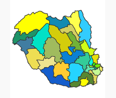
Data insight maps launch to support church growth
New data insight maps, launched this week in the Diocese of Llandaff, will support support church growth and community outreach

Maps for 33 Ministry Areas in the Diocese have been created to show their distinctive characteristics due to their geographical location, their demographic make-up and their cultural heritage. These distinctive characteristics have been quantified and brought together using Census data and Church in Wales attendance figures to highlight the unique nature of each Ministry Area.
This data will will help Ministry Areas make informed decisions about how best to serve our communities
Each map paints a picture of the local area by breaking down population data by age, Welsh language skills, education and areas of deprivation. This data provides a powerful tool for understanding the needs of the local community.
Paul Booth, Vision Programme Manager, says, "Understanding the communities that we serve in our newly formed Ministry Areas is essential as we plan together to deliver our Diocesan vision. By accessing the maps Ministry Areas will understand more about the people who live, work and believe in their area and support in the planning of services, events and outreach activities.
"This rich data will will help Ministry Areas make informed decisions about how best to serve our communities. I look forward to working with our Ministry Areas as we plan for mission and ministry in 2022."
Access the insight maps
To access the data insight maps, visit the Ministry Area section of the website can click on Ministry Area and choose Data Insight Maps.
Contact the Diocesan Office if you have any questions about the insight maps.