South Wales' first digital churchyard map launches
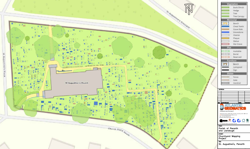
St Augustine’s Church Penarth is the first in Wales to digitally map its churchyard using Atlantic Geomatics Burial Ground Management System (BGMS).
The burial system allows users to access a location of a grave, the burial register entry and a photo of the headstone via an easy-to-use portal. The churchyard was scanned using a state-of-the-art drone and a digitised map of the churchyard was created.

St Augustine’s was the burial site in Penarth before the opening of Penarth Cemetery and contains many old and interesting graves. Volunteers Lindsay Cuddy, Linda Guilfoyle and Viv Liles transcribed more than 7,000 entries from the burial books onto the burial system.
Photographs of nearly 700 the graves were taken, and volunteers matched these to the burial records to provide an accurate record of the burial sites.
The burial system provides an accurate, interactive map showing the locations of graves.

Members of the public can view online a plan of the churchyard and look up details of burials from 200 years ago and, in many instances, find the location of the graves.
The Diocese of Llandaff funded the initial survey of the churchyard and the scanning of the burial records. The project is led by members of The Friends of St Augustine’s with financial support from the Heritage Lottery Fund and Allchurches Trust.
Explore St Augustine's digital burial map: www.penarth.burialgrounds.co.uk/
Image of the digital map courtesy of Atlantic Geomatics www.atlanticgeomatics.co.uk)